Introduction
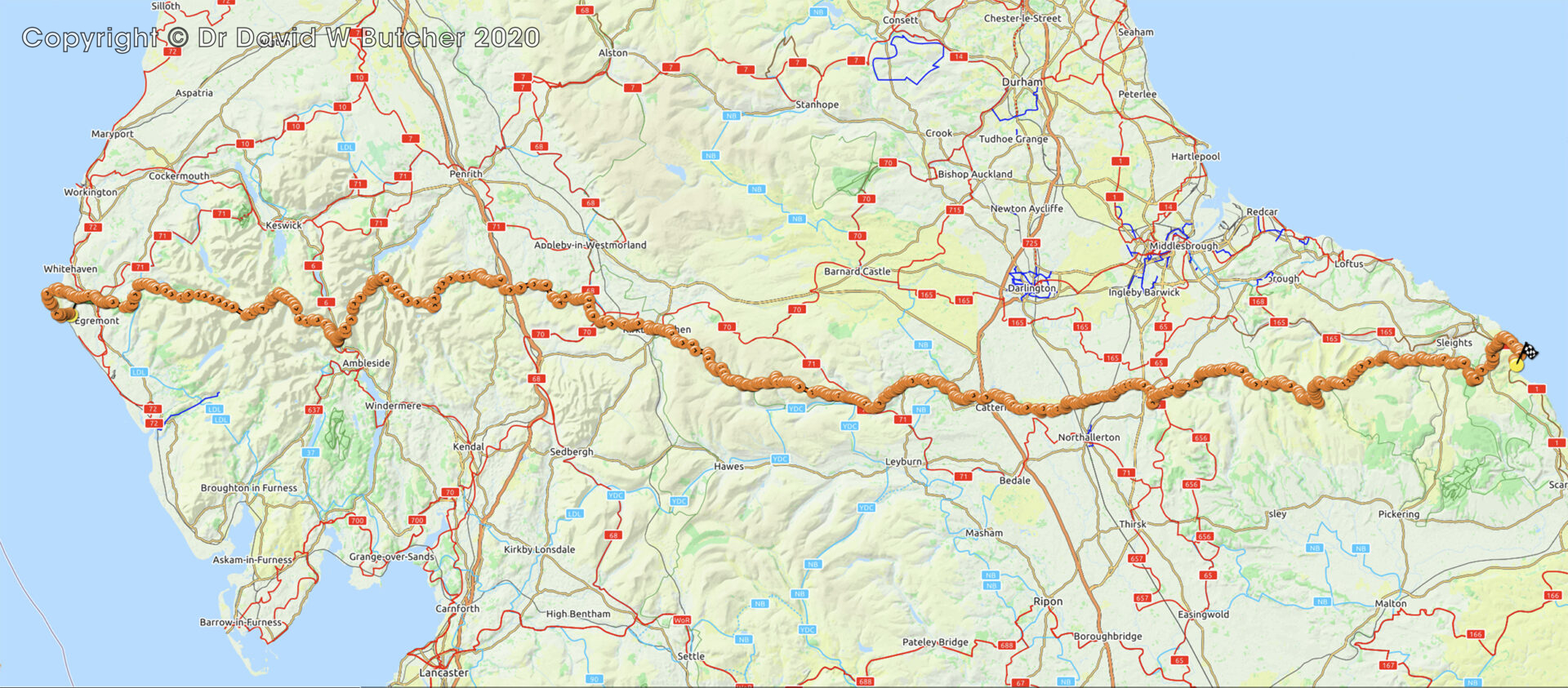
The route was devised by Alfred Wainwright in 1973 and he wrote the original guidebook that described it. It runs across northern England for just under 200 miles from St Bees Head in Cumbria (Irish Sea coast) to Robin Hood’s Bay in Yorkshire (North Sea coast) and goes through very varied and spectacular countryside including the Lake District, Pennines and North York Moors. For information, the hamlet of Keld in the Pennines is roughly halfway.
It is considered to be the most popular long distance trek in the UK but for some strange reason it has not been recognised as a National Trail. This means that it is not marked on Ordnance Survey (OS) maps and is not officially signposted. Cumbria in particular was very poorly signed in 2011, mostly being indicated by normal Public Footpath signs and hand-written signs provided by local farmers to help keep walkers on the trail. Yorkshire was much better and did have lots of Coast to Coast signs in 2012-2013. Fortunately, there are 2 Harvey’s maps that cover the entire route and mark it clearly on the map.
It’s an excellent walk and I have done it twice, always in the west to east direction.


 Get some free printing and developing tips, tutorials and information from the expert over at Darkroom Dave!